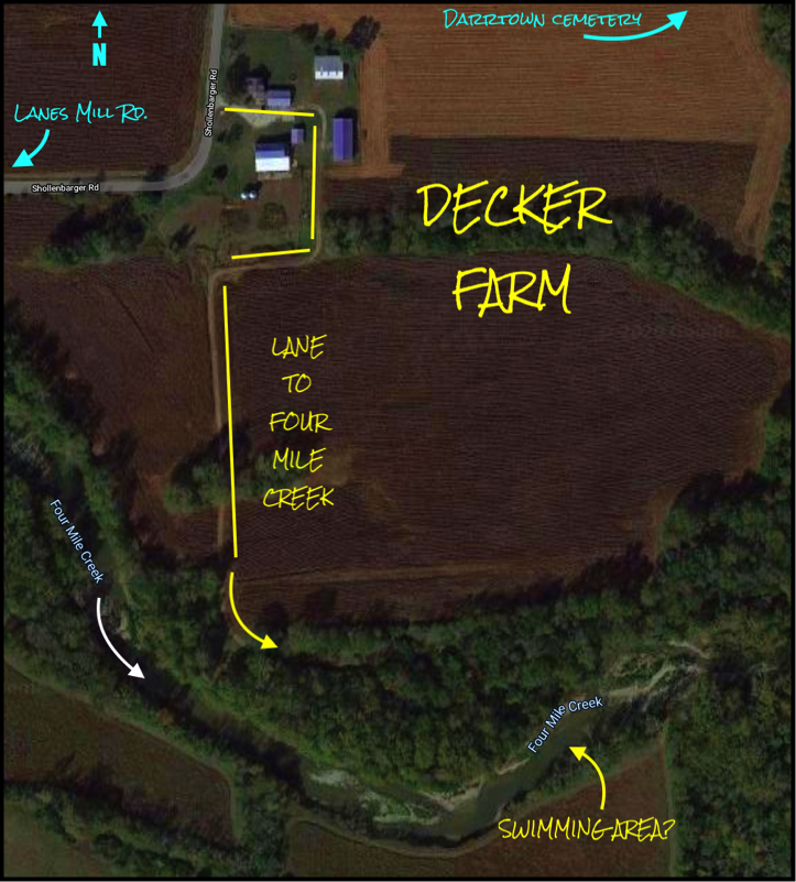
The 1931 and the 1955 drowning incidents occurred at Four MIle creek south of the Decker farm, which is located on the east side of Shollenbarger Road, west of the Darrtown cemetery (see the two illustrations below). The probable swimming area is noted at the bottom of the first image.


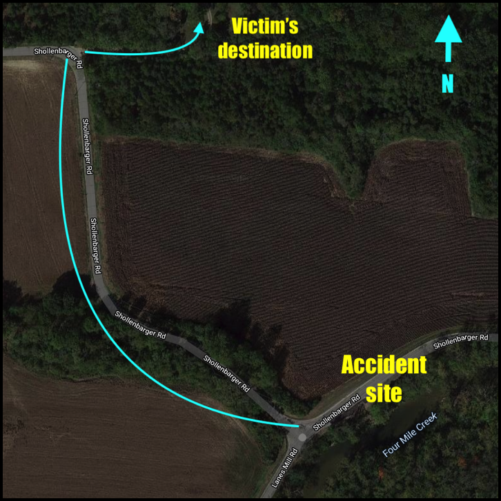
The 1956 Four Mile creek drowning resulted from an auto accident that occurred on a curve in Schollenbarger Road, just a few yards northeast of where Schollenbarger Road intersects with Lanes Mill Road. At that intersection, as seen in the two following images, Schollenbarger Road turns (west) and Lanes MIll road begins (south). The accident victim, Mrs. Romilda Gforer was about two-tenths of a mile from her destination - the home of her brother and sister-in-law, Edward and Marie Pater - where a bridal shower was being held for their daughter, Patricia.
Newspaper accounts and a personal recollection verify that
a "hole" - or step-off area -
lurked beneath the surface
of the Four Mile creek,
south of the Decker property.


The June 29, 1931 news story includes these comments:
"Reaching the deep hole in the creek..."
"is believed to have slipped and slid in the step-off, which led to the deep hole."
"slipped into the step-off and disappeared under the water."
The July 5, 1955 news story includes this comment:
"Today's drowning occurred in 11 feet of water."
As evidence, consider the following newspaper references to a "hole" in the creek where the 1931 and 1955 drownings occurred.
The location of the 1967 Four Mile creek drowning is reported (in a newspaper account) to have occurred at the "Four Mile Creek Park." The news article does not specify the location of the park. If you have info that will help locate the Four Mile Creek Park of 1967, please use the link in footer of this page to inform the webmaster.
Also, consider the personal experience of Harlan Miller - as he recalls a youthful experience in the swimming hole south of Decker's farm and the surprising change in the temperature of the water. Harlan's memory is reported at the Anecdotal Records page.
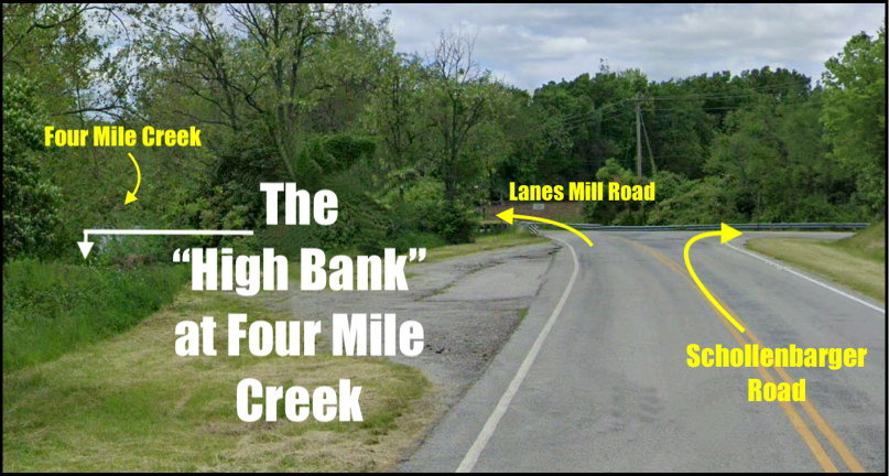
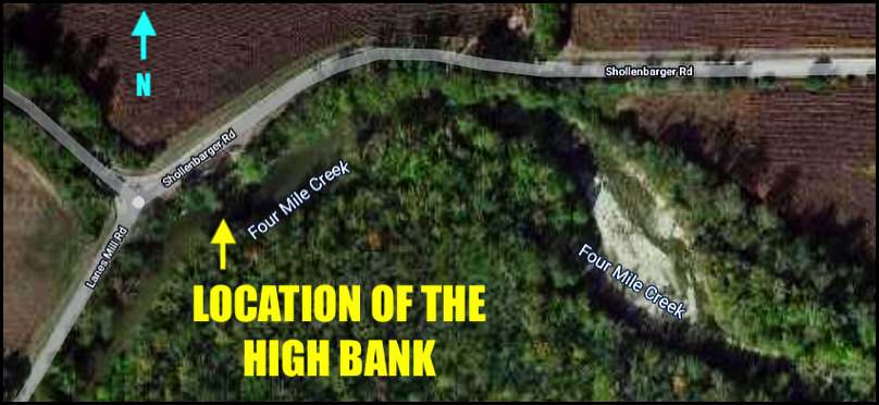
The 1930 drowning occurred at an area along the Four Mile Creek, southwest of Darrtown, that is know locally as the "high bank" (see more info at the 1930 drowning page). The following images shows the location of the high bank.
These links connect to items further down this page.
COMMUNITY - PAGE 3: Drowning LOCATIONS

√
1872 drowning location

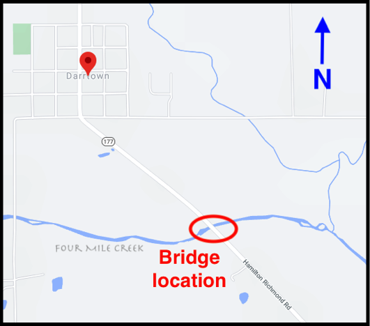
The 1872 drowning occurred near the bridge that crosses the Four Mile Creek, south of Darrtown.
No photos of the bridge from that time period have been found.
The map at the right shows the general area of the incident.