

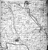
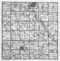
James McBride initiated the work that produced the 1836 map of Milford Township. McBride's map is sponsored on the Internet by roots web.ancestry.com. To see the 1836 map of Milford Township at the rootsweb site: click the following link; when the site opens, locate Milford Township; and choose to view either the northern or southern section of the township. Here is the rootsweb link: https://usgenwebsites.org/OHButler/mcbrides1836.html
1836 MAP OF MILFORD TOWNSHIP
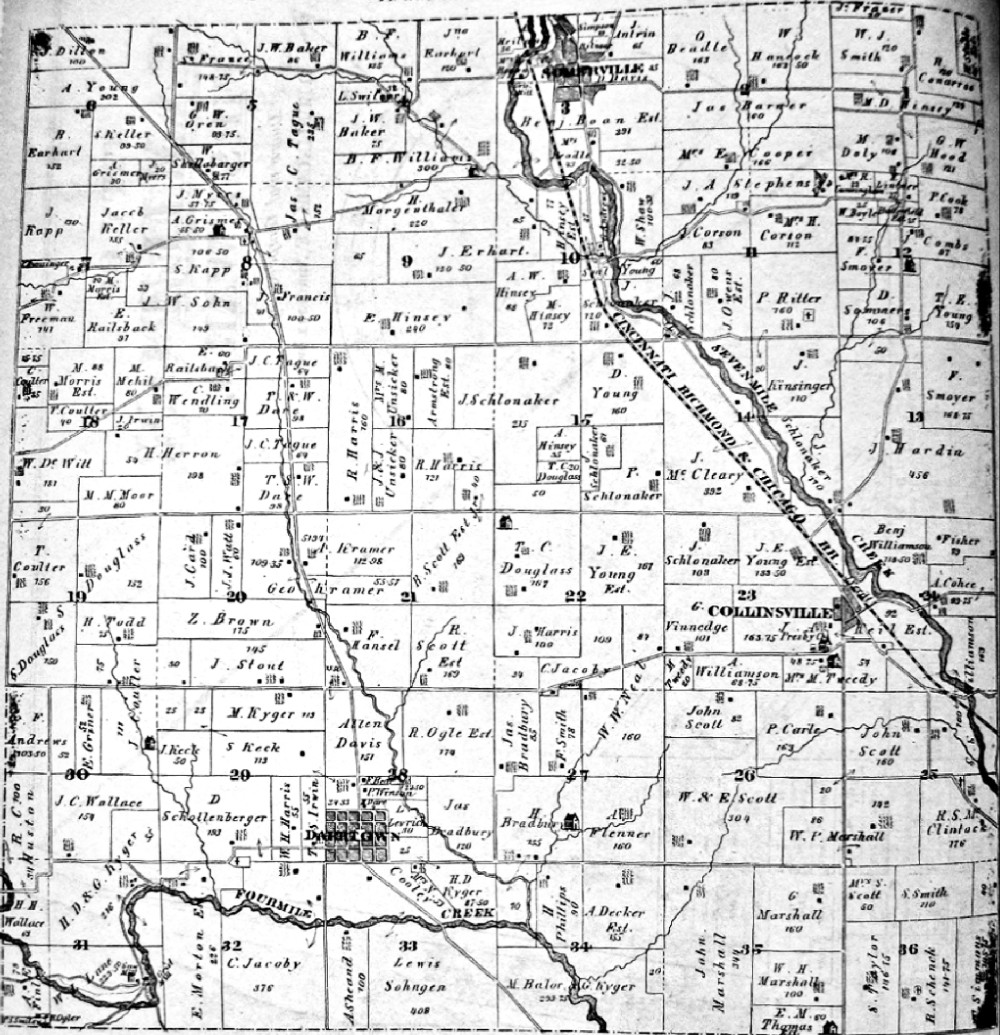
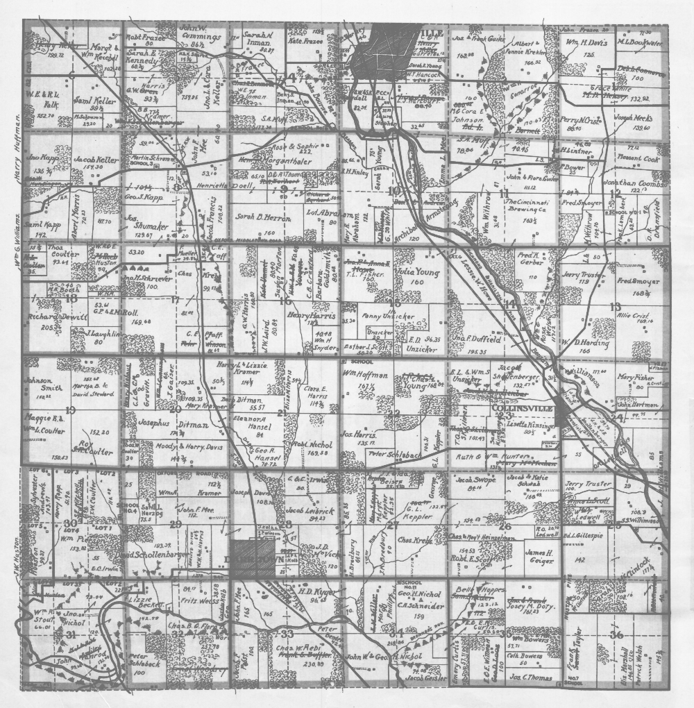
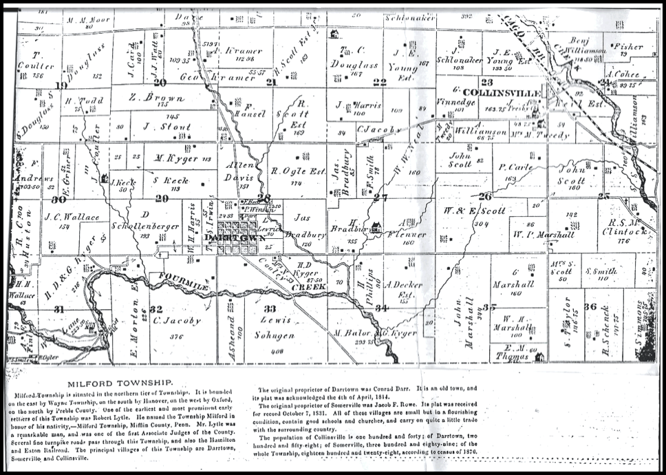
1875 MAP OF MILFORD TOWNSHIP
Marvin Russell contributed this 1875 map of Milford Township, in December, 2018.
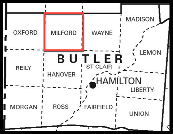
MILFORD TWP.
Milford Township is situated in the northern and central part of Butler County, Ohio.
Milford Township is one of 13 Butler County townships.
Click the following link to see an enlarged view of the
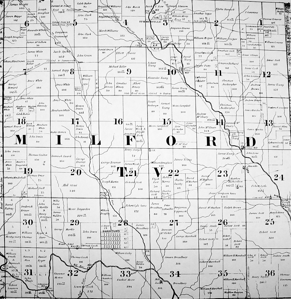
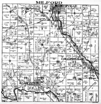
1855 MAP OF MILFORD TOWNSHIP
Click the following link to see an expanded and annotated view of the 1855 Milford Township map.
This map provides the first documented confirmation of the intended route of the railroad in the Darrtown area. The route was envisioned to extend from Hamilton to Oxford and beyond. As shown on the map, the intended route traversed township sections 31, 32, 33, and 34 along the southern border of Milford Township.
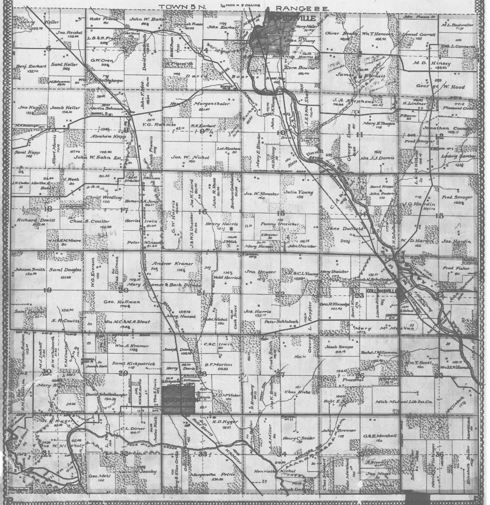
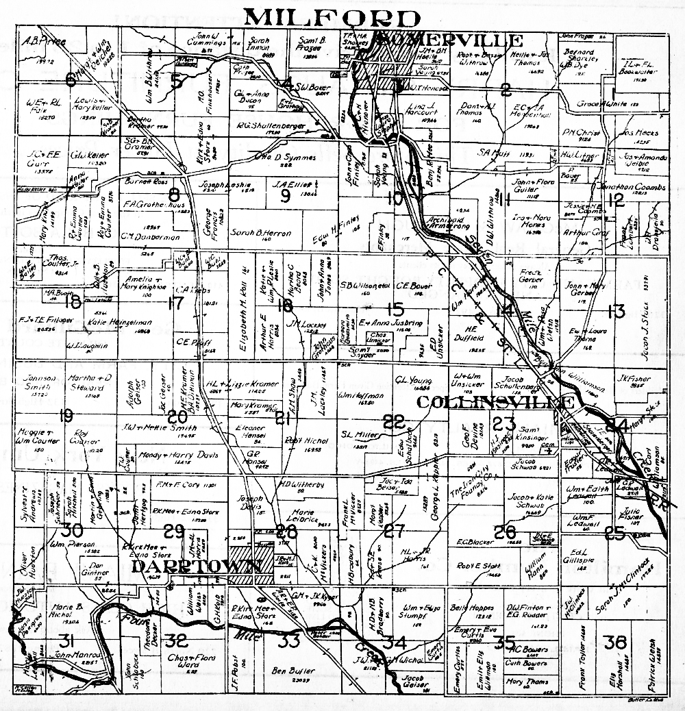
1895 MAP OF MILFORD TOWNSHIP
Marvin Russell contributed this 1895 map of Milford Township, in April, 2022.
1914 MAP OF MILFORD TOWNSHIP
The 1914 map is also available at the following link, which is sponsored by historicmaps.com. The historicmaps site includes zoom and drag features.
Click the link beneath the map image to see an enlarged view.
Marvin Russell contributed this 1914 map of Milford Township, in April, 2022.
Click the link beneath the map image to see an enlarged view.
Click the link beneath the map image to see an enlarged view.
1925 MAP OF MILFORD TOWNSHIP
Click the link beneath the map image to see an enlarged view.
Marvin Russell contributed this 1925 map of Milford Township, in April, 2022.
1930 MAP OF MILFORD TOWNSHIP
Click the link beneath the map image to see an enlarged view.
Marvin Russell contributed this 1930 map of Milford Township, in April, 2022.
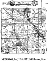
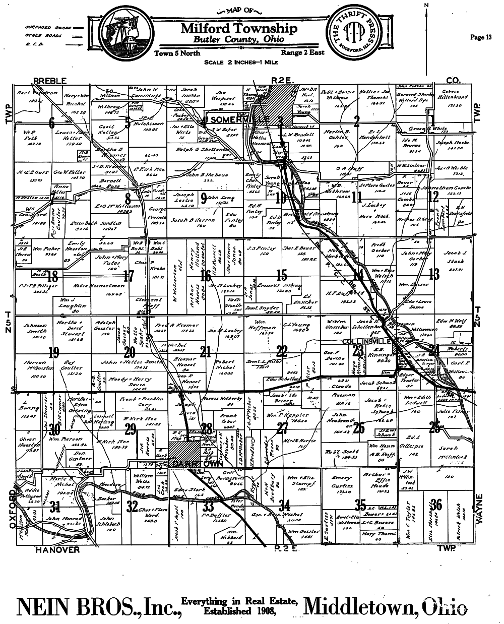
1958 MAP OF MILFORD TOWNSHIP
Click the link beneath the map image to see an enlarged view.
Marvin Russell contributed this 1958 map of Milford Township, in April, 2022.
"On this circa 1880 plat map of Milford Township in Butler County, Ohio, the property of Ebenezer Morton, Jr. (January 12 1812, to January 17, 1881) is clearly depicted on the western portion of Section 32. This property, and perhaps another, originally belonged to Ebenezer Morton, Sr. (Dec. 25, 1776, in Delaware to May 20, 1861 in Butler County, Ohio) and Rebecca Hinsey Morton (1981-1850).
The 1870 U. S. Federal Census reports that George Reynolds Morton (1846-1920) and Elizabeth (Morton) Morton (1847-1933) resided next to or with George's uncle, Ebenezer, at which time he was the eldest of the surviving two sons of Darrtown, Ohio, pioneers Ebenezer Morton, Sr. (1776-1861) and Rebecca Hinsey Morton (Circa 1781 to 1850).
Apparently George fReynolds Morton farmed part of Ebenezer’s property as a tenant. Therefore, 1880 would be the most plausible estimate of the last publication date of this particular plat map. The 1880 Federal U.S. Census reports that George and Elizabeth Morton at that time resided in the same place where they had resided in 1870 but without mentioning uncle Ebenezer Morton who had died on January 17, 1881.
At some point, George and Elizabeth Morton moved to a rental house on McGlynn Street in Hamilton, seat of Butler County, Ohio, and then during 1919 moved to the home of their son, William Welsh Lewis Morton, and his wife, Anna Schultheiss Morton, on Walnut Street at Elmwood Place in Hamilton County, Ohio, where George died in 1920 and Elizabeth in 1933.
Most Butler County, Ohio, plat maps should be available on-line or through the Butler County Achives in Hamilton. This caption was written by Judy Morton Brueneman and Bruce Morton Garver, two of the great-great- great-grandchildren of Ebenezer Morton, Sr."
This map that appears below was among items donated by descendents of the Ebenezer Morton family.
1880 MILFORD TOWNSHIP MAP - SECTIONS 19 to 36
(the southern half of township)
"MILFORD TOWNSHIP
Milford Township is situated in the northern tier of Townships [in Butler County, Ohio]. It is bounded on the east by Wayne Township, on the south by Hanover [township], on the west by Oxford [township], on the north by Preble County.
One of the earliest and most prominent early settlers of this Township was Robert Lytle. He named the Township Milford in honor of his nativity, - Milford Township, Mifflin County, Penn. Mr. Lytle was a remarkable man, and was one of the first Associate Judges of the County.
Several fine turnpike roads pass through this Township, and also the Hamilton and Eaton Railroad. The principal villages of this Township are Darrtown, Somerville, and Collinsville.
The original proprietor of Darrtown was Conrad Darr. It is an old town, and its plat was acknowledged the 4th of April, 1814.
The original proprietor of Somerville was Jacob F. Rowe. Its plat was received for record October 7, 1831. All of these village are small, but in a flourishing condition, contain good schools and churches, and carry on quite a little trade with the surrounding country.
The population of Collinsville is one hundred and forty; of Darrtown, two hundred and fifty-eight; of Somerville, three hundred and eighty-nine; of the whole Township, eighteen hundred and twenty-eight, according to the census of 1870.”
The notes that appear on the 1880 map above are replicated below. Supplemental information - provided by the webmaster - appears in the bracketed font.

The following information accompanied the 1880 map that the Morton family descendants donated.
Return to MAPS
Return to MAPS