

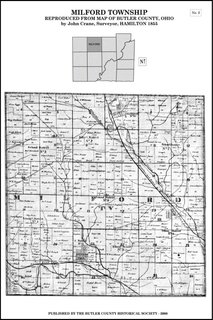
March, 15, 2018: The following map of Milford Township, Butler County, Ohio was found at the Butler County Historical website; see: http://bchistoricalsociety.com/main/2015/06/1855-map-butler-county/
Occasionally, Internet links are broken or removed by the host websites.
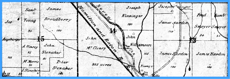
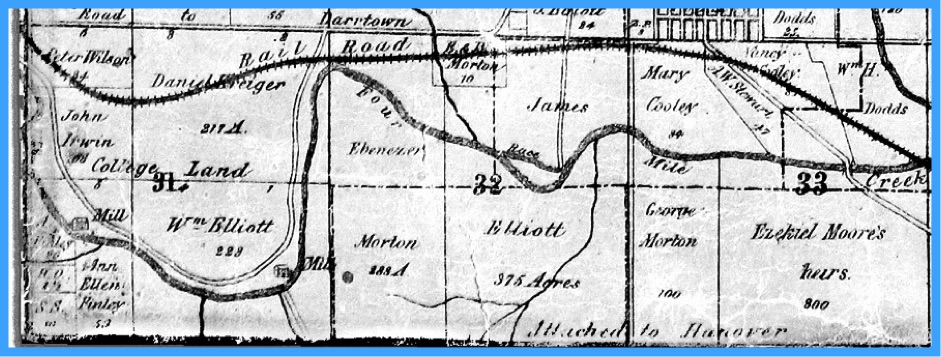
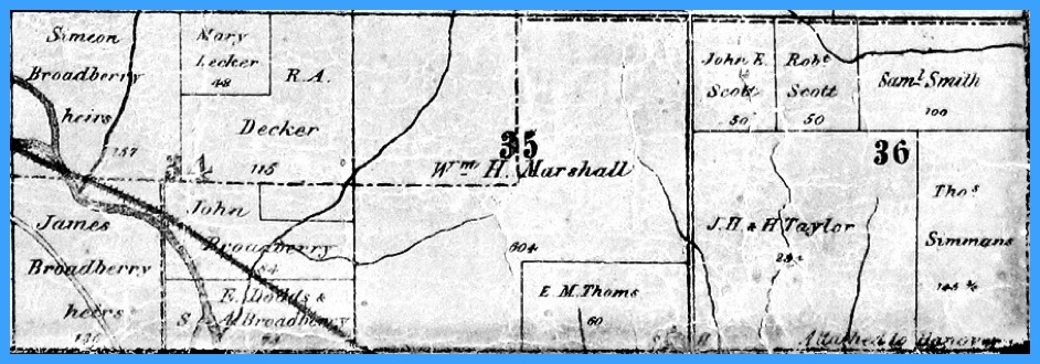
The 1855 map (ABOVE) is significant to the history of Darrtown, because, as of March 2018, this is the first revelation of the intended route of the Four Mile Valley Railroad - as it was envisioned to extend from Hamilton to Darrtown and beyond.
The following annotated map shows several 19th century points of interest in Milford Township.
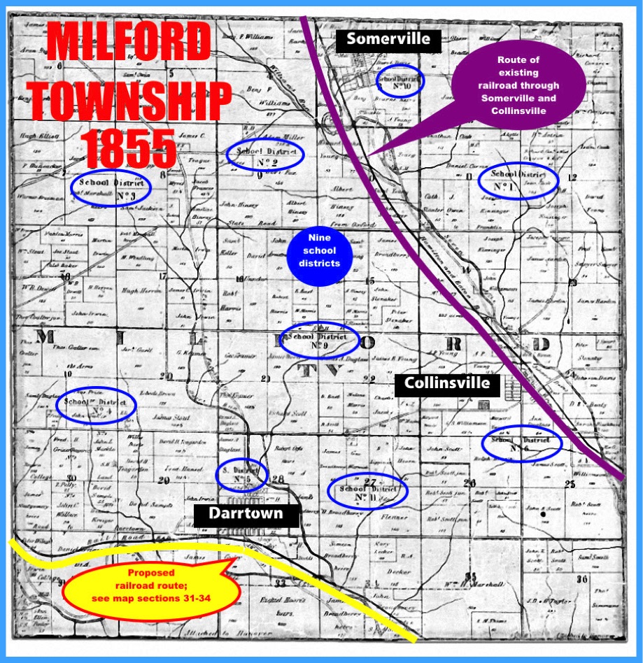
1855 MAP OF MILFORD TOWNSHIP - ANNOTATED
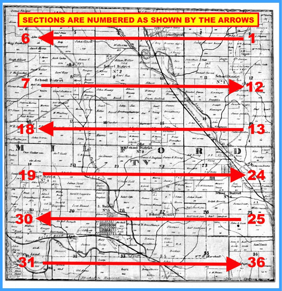
Milford Township is sub-divided by 36 sections, each one mile square. The following image shows how the sections are numbered.
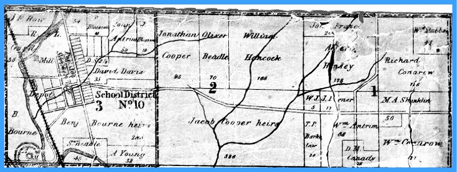
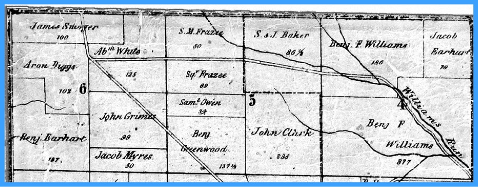
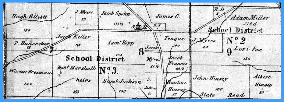
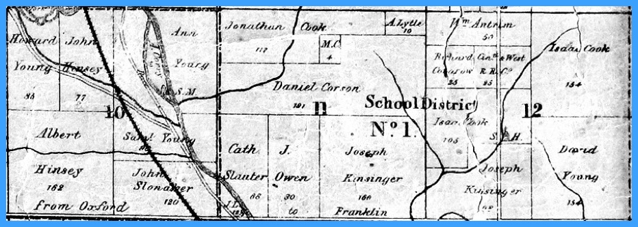
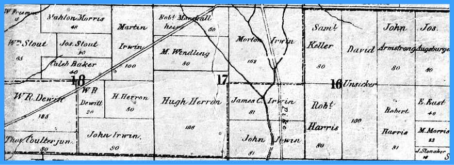
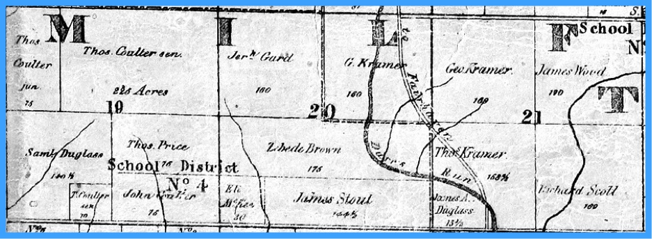
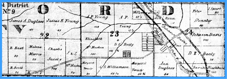
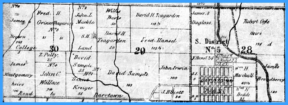
To make it easier to view the 1855 map, it has been enlarged and segmented into the following 12 images.
Each image displays THREE sections of Milford Township.

When that occurs, valuable content is lost.
To guarantee the continued display of the 1855 map of Milford Township, at this website, an image of the 1855 map was snagged from the host website and replicated here.

Replicated image
Click the following link to see more about the proposed Four Mile Valley Railroad.
Return to MAPS
Return to MAPS